
 GENERAL
6 Sept 2026
What’s the issue with the way Africa is shown on maps? | Explained
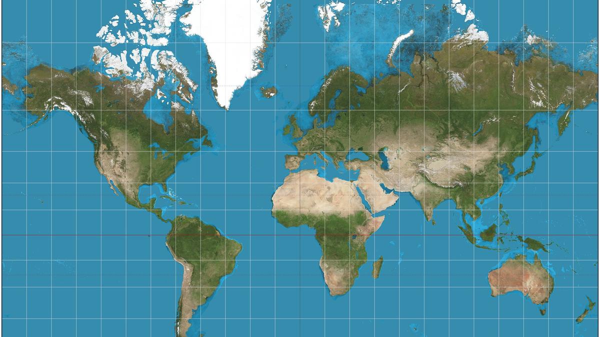
The African Union has endorsed the 'Correct the Map' campaign, which wants schools, media and online platforms to replace the Mercator projection with options like Equal Earth. Mercator, designed in 1569 for navigation, makes Africa look much smaller than Europe and Greenland. No flat projection is perfect, but this change shows true land sizes and reduces a long-standing symbolic bias.
Key Statutory Highlights
- The African Union has formally backed the 'Correct the Map' campaign to move from Mercator to equal-area maps like Equal Earth.
- The Mercator projection, invented in 1569 for sailing navigation, shrinks Africa's actual size while enlarging Europe, North America and Greenland.
- Schools, media and online platforms still use Mercator, so African leaders see the distortion as a symbol of marginalisation.
Actionable Advice for Taxpayers / Founders:If you select or share maps for your business or school materials, prefer an equal-area projection whenever country or market sizes matter; no legal action is required.
Statutory Disclaimer: TaxQue Shorts are AI-assisted editorial briefs for compliance awareness. This brief has not passed every source check; confirm the original notification before acting. This does not constitute formal legal or CA counsel.
TaxQue News Desk
Share: